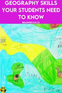
Teaching geography skills is one of our favourite activities because maps are generally objective. Students who like math tend to do well with map reading because they’re so black and white (no pun intended). Come learn some of the ways we bring geography skills alive for our students without just reading boring maps over and over.
Map Reading is an Important Geography Skill
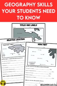
First of all, you’re not going to get away from teaching map reading skills. This is a vital skill for understanding and recording geography. But, the maps don’t need to be basic.
When we created our map skills reading lessons, we wanted to create maps that were creative and fun for students. Each of the maps is fictional. We had fun making up names for objects based on silly words or themes. There are specific lessons for titles, legends, scale, directions and landforms. These geography skills will serve your students well for life. We wrote a whole post about it: Fun Ways to Review Map Reading With Your Students.
You can find our Map Reading Skills resource in our TpT Store ($USD) or our BN Shop ($CAN). It also includes assessments and a creative map-making project that is a classroom favourite.
If your students need more practice reading maps and atlases, we created a whole post about using maps as a scavenger hunt. It includes scavenger hunts for each of the provinces across Canada. There’s even a general one about Canada. Read Disguise Research Skills as a Scavenger Hunt.
Spatial Awareness is a Geography Skill
Spatial awareness means to understand the location of places, objects and features in relation to one another. If you’ve ever received driving instructions from someone who has no spatial awareness, you can understand why this is such an important skill. I’m sure there’s a ninja relative out there driving in circles right now.
To practice spatial awareness, students need to create and read lots of maps. They will begin to learn how far objects are between each other and how the size of the object works in relation to others.
You can have students create maps of their homes, classrooms or neighbourhoods. These maps can be two-dimensional maps or drawings or students can get more creative and make three-dimensional models or dioramas.
We created a resource called Map Quest. This resource hires students to create maps for a database, but it means you don’t have to do any prep to figure out what students will need to do. Find Map Quest on TpT Store ($USD) or in our BN Shop ($CAN).
Create a map using butcher block paper. Have students place pictures or drawings of different places (e.g., home, school, park) on the map and label them.
Design a treasure hunt based on a map of the school or local community.
Create a map out of dough. It can include the mountains, valleys or rivers in a three-dimensional way.
Geographic Perspectives are Skills
Understanding how different people view and interact with the world is a geography skill. It is important to understand how the geography of an area contributes to life.
Natural Resources
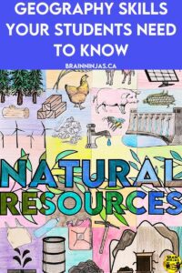
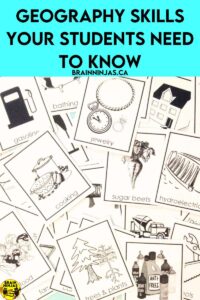
Natural resources are one way that life can be impacted by geography. We have written several resources about natural resources. Some are general while others are specific to locations.
Natural Resources focuses on a variety of resources, but they are found in Canada. Find it on TpT Store ($USD) or in our BN Shop ($CAN). There are various activities including a simple art project.
Natural Resources Collaborative Poster can be found on TpT Store ($USD) or in our BN Shop ($CAN). These resources aren’t specific to a region.
Alberta’s Natural Resources can be found on TpT Store ($USD) or in our BN Shop ($CAN). This resource is part of our Alberta Science curriculum and focuses on the natural resources in the province of Alberta. It includes reading maps where resources can be found in Alberta.
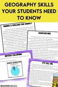
Energy Resources focuses on the natural resources used in Canada to produce energy. It is part of the Alberta Science curriculum. Find it on TpT Store ($USD) or in our BN Shop ($CAN).
We also have a post about natural resources along with more activities. Read Make the Best of Your Natural Resources Lessons.
Cultural Connections
Many cultural traditions are connected to geography and the land. For example, many different Indigenous People across Canada celebrate and honour the land in different ways. Everything from ceremonies and celebrations to music and art had the land woven through it.
Buildings and landmarks are part of the geographical landscape. We create art projects that examine the landforms and landscapes of the regions we study. Most of these art projects have been put together in our Geography and Landscapes Art Projects. The projects come with step-by-step lesson plans, photographs of finished projects and reflection pages in English and French. Find Geography and Landscapes Art Projects in our TpT Store ($USD) or our BN Shop ($CAN).
If you’d like to try one of the lessons for free, we’ll send it to you when you sign up for our email list. If you’re already on the list, you can find it in our Resource Library.
Students can research and present a famous place with cultural significance in the world. Students can create travel brochures or presentations to share their findings.
Geographic Thinking
Asking questions about the world and using geographic tools to find answers is a necessary geography skill. Understanding the geography of an area is important for understanding everything from climate to weather and why cities are built where they are.
Students can use online mapping tools (e.g., Google Maps, Google Earth) to explore different places around the world. They can measure distances, identify landforms, and locate cities.
We created resources to teach students about the geographical regions of Canada and Alberta specifically. They include background information for teachers so you don’t have to search out all the research yourself. There are lesson plans, student templates and projects that students can do to learn about the regions. We’ve even included rubrics for marking and reflection pages for students to use.
Find Canada‘s Geographical Regions Project Bundle in our TpT Store ($USD) or our BN Shop ($CAN).
Find Alberta’s Geographical Regions Project Bundle in our TpT Store ($USD) or our BN Shop ($CAN).
Students can do other projects to learn about a region. Conduct a local environmental survey. Students can collect data on the types of plants, animals, and pollution in their neighbourhood, city or province.
Use Geography Skills All Year Long
While you might start your school year with a geography unit, it’s important to teach geography skills all year. Maps and charts will appear in social studies as well as in math, science and even art. The more your students are exposed to maps through reading and creating them, the stronger their geography skills will become.
Let us know your favourite geography skills activities in the comments below.

